
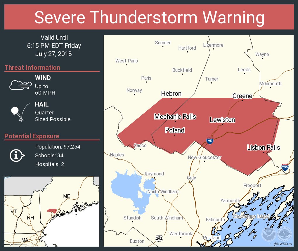
 The atmosphere is primed for thunderstorms this afternoon through early tonight. An approaching cold front will be the trigger to touch these storms off. The potential exists for strong and severe storms between 3PM and 10PM. Damaging winds, hail, and flooding are possible. That risk is greatest inland and mountains. The front will be slow to slip off shore, therefore expect another round of scattered thunderstorms on Saturday. The risk for severe weather is slightly lower on Saturday. Sunday still looks to be the best part of the weekend with mostly sunny skies and seasonably warm temperatures. Humidity levels won’t be quite as high on Sunday either. The first few days of the work week are looking sunny and warm. Unfortunately the humidity will become high once again and we’ll introduce more showers and t-storms Wednesday and Thursday.
— Charlie Lopresti, WGME Chief Meteorologist
Comments are no longer available on this story